
Miranjani Trek: A Complete Guide to Hiking Miranjani Top, the Highest Peak in the Galiyat
October 2026The Miranjani trek starts near Governor House in Nathiagali and climbs about 4.5 to 5 km each way, gaining roughly 600 metres, to the highest point in the Galiyat at about 2,992 metres. Most walkers need two to three hours up and four to six hours for the round trip.
Miranjani is longer, steeper and much quieter than the better-known climb to Mukshpuri, and it is the hike that regular visitors tend to graduate to once they have done the others. On the right morning it is also the best viewpoint within a few hours of Islamabad.
This guide covers where the Miranjani track begins, how far and how hard it is, how to do it at sunrise, what you can honestly expect to see from the summit, and how it compares with Mukshpuri if you only have time for one.
The short answer
Start near Governor House, allow two to three hours up and four to six hours in total including rests, and expect moderate to hard going: never technical, but sustained, with a steep and rocky final section and no signposts. April to June and September to October are the best months, and an early start gives you the best chance of a clear view.
Where does the Miranjani trek start?
The trailhead is on the upper side of Nathiagali, near Governor House and a short distance beyond St. Matthew's Church, the wooden church built in 1914 that most visitors walk up to anyway. From the bazaar it is a short drive or an uphill walk of around twenty to thirty minutes. There is parking near the start, and in season you will usually find guides and the odd tea stall there. If you are unsure of the exact turning, ask anyone in the bazaar for the Miranjani track; it is well known locally.
How long is the Miranjani trek?
Recorded tracks and guidebooks put the one-way distance at between about 4.7 and 5 km, so the round trip is roughly 9 to 10 km. Some sources quote a little less. The start is at around 2,350 to 2,400 metres, which makes the height gain close to 600 metres. There are no distance markers anywhere on the route, so it is worth noting your start time and pacing yourself by the clock.
How much time does it take to reach Miranjani top?
Fit, experienced hikers reach the summit in an hour and a half to two hours. Most people take two to three hours, and the descent takes about two-thirds of whatever the ascent did. With breaks and time on top, plan on four to six hours in total. That makes Miranjani a half-day to most-of-a-day outing rather than something to squeeze in before lunch.
Is the Miranjani trek difficult?
It is a clear step up from Mukshpuri, without being technical. The first half climbs steadily through dense forest on a soft dirt path wide enough for two people, narrowing in places. The second half is steeper, and the final approach to the summit is rough and rocky underfoot. There is no scrambling and no real exposure, but the climbing is sustained, and the altitude of nearly 3,000 metres is noticeable if you have just come up from the plains.
The other difficulty is navigation. The track is unmarked, and a few side paths used by villagers and livestock branch off it. In good weather, with other walkers about, the main line is easy enough to follow. In cloud, or on a quiet weekday, it is less so, which is the main reason a local guide is worth having on a first visit.
What can you see from Miranjani top?
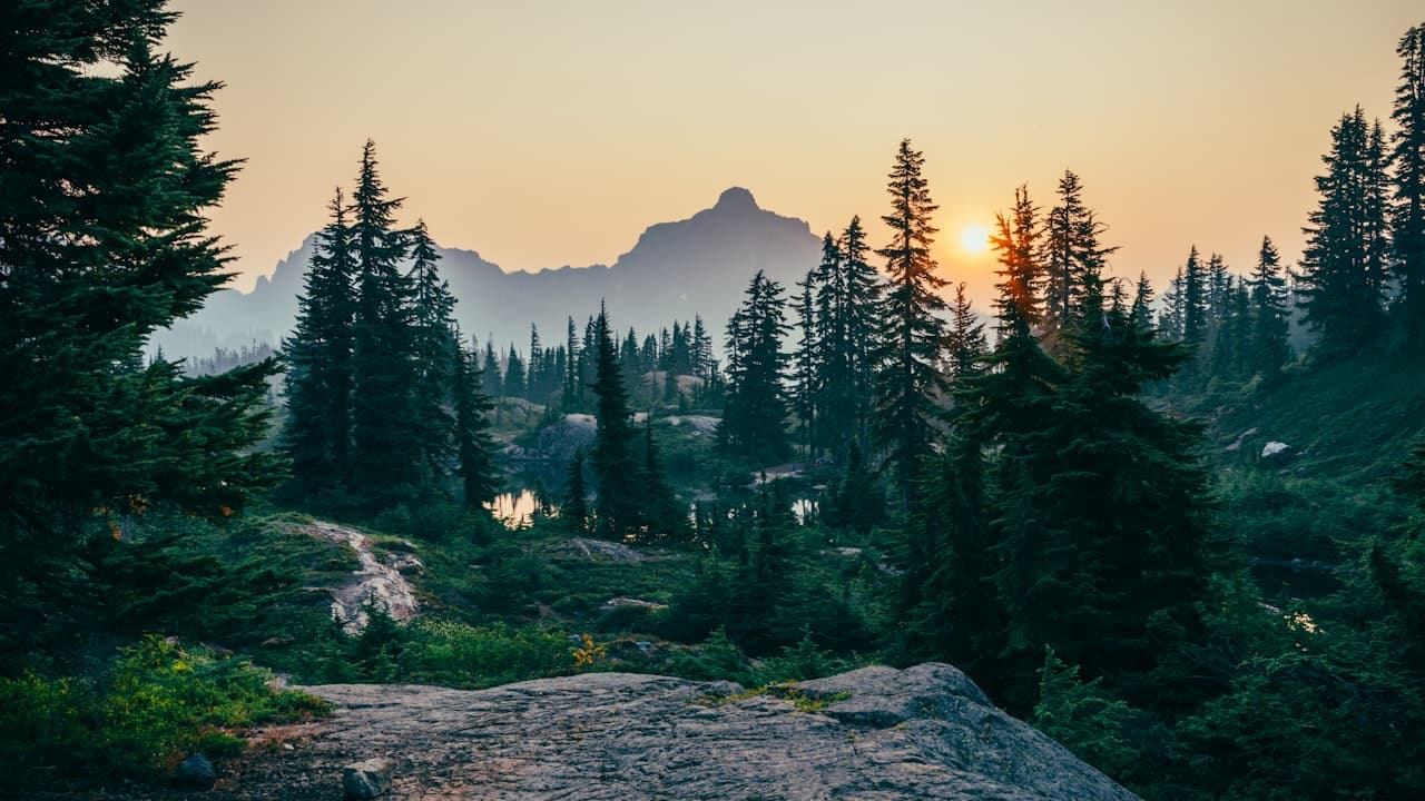
On a clear day the summit looks down on Nathiagali and across to Mukshpuri, north towards Thandiani and the Abbottabad side, and east over the ridges of Azad Kashmir towards the snow-covered ranges beyond. Many hikers report seeing Nanga Parbat, the ninth-highest mountain in the world, on the far northern horizon. That is a long way off, and it appears only in exceptionally clear air, most often early on an autumn or post-rain morning. Treat it as a bonus rather than a promise.
The honest caveat applies here even more than on Mukshpuri: cloud usually builds through the late morning, and in the monsoon the summit can sit inside it all day. The forest on the way up, with old pines and oaks and very few people, is reward enough on the days the view does not appear.
How do you hike Miranjani for sunrise?
Sunrise on Miranjani is the classic way to do it, because dawn gives the clearest air of the day. It means leaving the trailhead two to three hours before first light, so in practice between about 2.30 am and 4 am depending on the month. That has real consequences. You will be walking an unmarked forest trail in the dark, in leopard habitat, so go in a group of at least three or four, take a local guide who knows the path, and carry a headtorch each with spare batteries. Pack proper warm layers, gloves and a hot drink: the summit before dawn is cold in every month and close to freezing in spring and autumn.
If a pre-dawn start sounds like too much, a 6 am start still gets you to the top before the cloud on most fair days. Our day-by-day itinerary shows how to fit Miranjani around the easier walks so nobody is worn out.
See the 2 and 3 day Nathiagali itinerary →What is the best season for Miranjani?
April to June and September to October. Autumn is the pick for views, with dry paths and the clearest air of the year; late spring is the pick for green forest and comfortable temperatures. July and August bring wildflowers near the top but also the monsoon, which makes the steep upper section slippery and hides the view more often than not. From December to February the mountain is under deep snow, the path is hard to follow, and it should be left to experienced, properly equipped winter hikers with a guide.
Is the Miranjani trek safe? Wildlife and other hazards
Miranjani lies in the Ayubia National Park area, around 3,300 hectares of forest that is home to leopards; black bears are also reported on the higher ridges. Sightings are rare and the animals avoid people, but this is the reason for the standard advice: walk in a group, keep to the main path, make some noise in the forest, and be off the mountain before dusk unless you are with a guide.
The more likely problems are ordinary ones. There is no water, no shelter and no reliable stall anywhere above the trailhead, so carry at least a litre and a half per person, and food. Mobile signal comes and goes. Weather changes fast; if cloud drops or thunder starts, turn around. After heavy rain, give the path a day to dry. Tell your accommodation where you are going and when you expect to be back.
Mukshpuri or Miranjani: which should you hike?
Mukshpuri is about 2,800 metres, roughly 3 to 4 km each way, two to three hours up, busy, with horses and tea stalls in season and a big open meadow on top. Miranjani is about 2,992 metres, about 5 km each way with 600 metres of climbing, quieter, wilder, unmarked, and with the wider view on a clear day. If it is your first visit, you have children with you, or you have only half a day, climb Mukshpuri. If you walk regularly, have a full clear day and want to be away from the crowds, climb Miranjani. With a long weekend, do both: Mukshpuri first as a warm-up, Miranjani the next morning.
We have written a full companion guide to the other peak, covering both of its routes, snow hiking and what to carry.
Read the Mukshpuri trek guide →For a quick side-by-side that also includes the flat Pipeline Track, see our overview of hiking in Nathiagali.
Compare the three Nathiagali hikes →Where to stay for an early start
A dawn hike is far easier when you are already in Nathiagali the night before. MYG Nathiagali is on the main Nathia Gali road, two minutes' walk from the bazaar and a short drive from the Miranjani trailhead. The three-bedroom serviced apartment sleeps a hiking group comfortably, with three bedrooms, 3.5 washrooms, a lounge, a dining table for six and a fitted kitchen for a 3 am breakfast; there is a one-bedroom attic apartment for couples. Both come with free Wi-Fi, a smart TV and a tea setup, and when you get back there is a hot shower, an on-site cook and room service from the building's restaurant floor.
See the serviced apartments →Some people who come up for the trails every year eventually want a permanent base. The building also has 2 Bedroom (1,800 sq ft) and 3 Bedroom (2,100 sq ft) apartments for sale, built with an earthquake-resistant RCC frame and UPVC double-glazed windows for year-round use.
See the apartments for sale →To book a stay around a Miranjani hike, call +92 333 9111 550 or WhatsApp +92 334 4131332 with your dates and group size.
More Stories
Travel GuideAyubia National Park and the Pipeline Track: A Complete Visitor's Guide (Walk, Wildlife and the Chairlift)
 Travel Guide
Nathiagali Honeymoon Guide: Best Months, a 3-Day Couples Itinerary and Where to Stay
 Travel Guide
Nathiagali Road Conditions: Is the Road Open, and Can You Drive Up in Snow?
Want to Live in Nathiagali?
MYG Nathiagali — luxury apartments near Abbottabad, delivering 2026