
Mukshpuri Trek: Complete Guide to the Mukshpuri Top Hike (Routes, Distance, Time & Season)
October 2026The Mukshpuri trek climbs about 3 to 4 km from Dunga Gali or Nathiagali to a summit meadow at roughly 2,800 metres, and takes most people two to three hours up. Mukshpuri (also spelled Mushkpuri) is the hike most visitors to Nathiagali end up doing, and for good reason: it is the second-highest peak in the Galiyat after Miranjani, the path is clear, the climb fits into half a day, and the summit is a broad open meadow with views in every direction. It is a proper mountain walk that does not demand mountaineering fitness.
This guide covers both routes to Mukshpuri top, how long and how hard the trek really is, when to go, what changes in snow, and the practical details that most write-ups skip: horses, tea stalls, what to carry and when to turn back.
The short answer
The Mukshpuri trek climbs to roughly 2,800 metres from either Dunga Gali or Nathiagali. Each route is about 3 to 4 km one way, takes most people two to three hours up and around an hour and a half down, and is moderate in difficulty: a steady uphill walk on a clear path with no scrambling. The best months are April to June and September to October; in the monsoon the path is slippery, and from December to February it is a snow hike for properly equipped walkers only.
Where does the Mukshpuri trek start?
There are two established routes, and they start about 3 km apart. The first begins at Dunga Gali, the small settlement on the main road roughly 3 km from Nathiagali on the Ayubia side, which is also where the Pipeline Track starts. The second begins in Nathiagali itself and climbs via Lalazar, above the bazaar. Both meet on the summit meadow, which means you can go up one way and come down the other, then take a short taxi ride back to where you started.
The Dunga Gali side is the busier of the two. It is the route most families, tour groups and horse handlers use, the path is wide, and on a summer weekend you will rarely be out of sight of other walkers. The Nathiagali side is quieter and spends longer in dense forest before it opens out near the top.
How long is the Mukshpuri trek?
Here the published sources genuinely disagree, so treat any single number with caution. The Nathiagali route is usually given as 3.5 to 4 km one way. The Dunga Gali route is quoted at anything from 2.5 km to 4 km. Neither trail has distance markers, which is part of the reason. A fair working figure is 3 to 4 km each way on either side, or about 6 to 8 km for the round trip.
Sources also disagree on which side is steeper. Some describe Dunga Gali as the shorter, sharper climb and Nathiagali as the gentler, steadier one; others say the opposite. In practice the difference is small. Nathiagali sits at about 2,410 metres, so from either trailhead you are gaining somewhere in the region of 400 metres of height, spread over a few kilometres. Choose your route by where you are staying and how much company you want, not by gradient.
How much time does the Mukshpuri hike take?
Allow two to three hours for the ascent at an ordinary pace with photo stops, and an hour to an hour and a half for the descent. Fit, regular walkers do the climb in well under two hours. With time on the summit, the whole outing is four to five hours, so an 8 am start has you back in the bazaar for a late lunch. In snow, add at least an hour to the climb.
Is the Mukshpuri trek difficult?
It is moderate. There is no scrambling, no exposure and no route-finding to speak of in clear weather; the difficulty is simply that it goes uphill the whole way, at an altitude where people arriving from the plains notice their breathing. Anyone who walks regularly will manage it comfortably. School-age children do it routinely. People who do no exercise at all will find the last third hard work but still achievable with rests.
If anyone in your group is unsure, walk the flat Pipeline Track first and see how it feels. Our overview of the three classic Nathiagali trails compares the Pipeline Track, Mukshpuri and Miranjani side by side.
Compare the three Nathiagali hikes →Already done Mukshpuri and want a harder, quieter summit? Miranjani, about 2,992 metres, starts in Nathiagali itself.
Read the Miranjani trek guide →What will you see from Mukshpuri top?
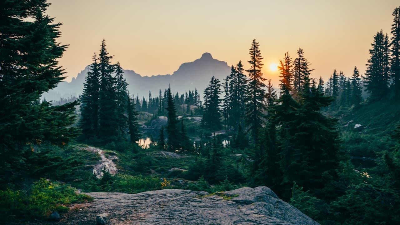
The lower part of both routes runs through the conifer forest of the Ayubia National Park area, which covers around 3,300 hectares: pine, fir and oak, with birdsong most of the way and monkeys near the trailheads. Near the top the trees give way to open grass, which fills with wildflowers from late spring into the monsoon. From the summit, on a clear day, you look down over Nathiagali and Dunga Gali, across the ridges towards Murree, and east over the Jhelum valley towards the hills of Azad Kashmir.
The honest caveat is that clear days are not guaranteed. Cloud often builds from late morning, particularly between July and September, and it is entirely possible to reach the top and see nothing but white. Starting early is the single best thing you can do for the view.
What is the best season for the Mukshpuri trek?
April to June and September to October are the best months. Spring brings cool air, green slopes and flowers on the summit meadow; autumn brings the clearest visibility of the year and dry paths. June to August is warm and perfectly walkable but busy, and the monsoon, from July into September, makes the track muddy and slippery and hides the view more often than not. Check the forecast the night before and go early.
For a fuller picture of weather, crowds and what to pack across the year, see our month-by-month guide.
Read the best time to visit Nathiagali →Can you hike Mukshpuri in snow?
Yes, and it has become a popular winter outing, but it is a different undertaking. Heavy snow falls in the Galiyat from December to February, and the track can stay snow-covered into March. Expect the climb to take three to three and a half hours, the path to be packed ice in the shaded sections, and the summit to be bitterly cold in any wind. You need waterproof boots with real grip, gloves, a hat, warm layers and ideally a walking pole. Go with a group or a local guide, start by mid-morning at the latest so you are down well before dark, and check that the road to the trailhead is open before you set out.
Are there guides, horses and shops on the trail?
Horses are available at both trailheads in season and will carry a rider most of the way up; agree the fare and how far it covers before you set off. Local guides can be arranged in Nathiagali and Dunga Gali. In fair summer weather the route is obvious and most people go without one, but a guide is sensible in snow or for a first visit with children.
Tea and snack stalls operate near the trailheads and, in the busy months, at points along the track and on the summit. They are seasonal and informal, so do not plan around them. Reports on entry tickets are mixed: parts of the route fall within the national park and some visitors report paying a small fee at the Dunga Gali side, while others mention none. Carry some small change and do not be surprised either way. There are no toilets or reliable water sources on the trail.
What should you carry?
Walking shoes or boots with proper grip, at least a litre of water per person, a windproof or warm layer for the summit even in July, and a rain shell in every month. Add sun protection, snacks, a charged phone and some cash. Carry all your rubbish back down; litter on the summit meadow is the one thing that spoils this hike.
Is the Mukshpuri trek safe?
For a mountain walk, it is about as safe as they come, provided you respect three things. First, weather: if cloud closes in or thunder starts, turn around rather than push for the top, because the open summit is no place to be in a storm. Second, daylight: be off the mountain before dusk. Third, wildlife: this forest is leopard habitat. Encounters are rare, but walk in a group, stay on the main track, keep children close and do not feed the monkeys. Mobile signal is patchy in the forest, so tell someone at your accommodation when you expect to be back.
A base two minutes from the bazaar
MYG Nathiagali sits on the main Nathia Gali road, two minutes' walk from the bazaar, which puts the Nathiagali trailhead within walking distance and Dunga Gali a few minutes away by car. The three-bedroom serviced apartment has three bedrooms, 3.5 washrooms, a lounge with a smart TV, a dining table for six and a fitted kitchen, with an on-site cook and room service from the building's restaurant floor, so the plan after the hike can be as simple as a hot shower and a meal that someone else makes. There is also a one-bedroom attic apartment for couples, and both include free Wi-Fi, a smart TV and a tea setup.
See the serviced apartments →If you are wondering how the trailheads, the bazaar and the road from Islamabad fit together, the location page lays it out.
See where MYG Nathiagali is →To book a stay around a Mukshpuri hike, call +92 333 9111 550 or WhatsApp +92 334 4131332 with your dates and the size of your group.
For walkers who keep coming back, the building also has 2 Bedroom (about 1,800 sq ft) and 3 Bedroom (about 2,100 sq ft) apartments for sale.
See the apartments for sale →More Stories
 Travel Guide
Miranjani Trek: A Complete Guide to Hiking Miranjani Top, the Highest Peak in the Galiyat
Travel GuideAyubia National Park and the Pipeline Track: A Complete Visitor's Guide (Walk, Wildlife and the Chairlift)
 Travel Guide
Nathiagali Honeymoon Guide: Best Months, a 3-Day Couples Itinerary and Where to Stay
Want to Live in Nathiagali?
MYG Nathiagali — luxury apartments near Abbottabad, delivering 2026